Plan Calls for Streetcar Line Under Whitehurst
By Katie PearceCurrent Staff Writer
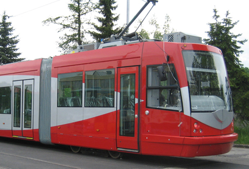
A new streetcar line has emerged as the best option for linking Georgetown to Union Station, according to a final D.C. Department of Transportation report on “premium transit” options for the corridor.
The study, published Monday, lays out an optimal 3.4-mile path for the streetcar via K Street and New Jersey Avenue NW to H Street NE — stopping at eight stations along the way. The project would cost an estimated $347.7 million to build, and $9.1 million annually to operate.
Next up, the Transportation Department will start the environmental review and approval process, expected to take one or two years, according to agency spokesperson Monica Hernandez.
With the proposal, the department has refined its broader plans for a “One City” streetcar line cutting across the center of the District, from Georgetown to the Benning Road Metro station in Northeast.
A streetcar was one of several premium transit options the study investigated for the Georgetown to Union Station stretch, along with light rail and different types of buses. After launching research last January with a $1 million grant from the Federal Transit Administration, D.C. transportation officials narrowed the alternatives over the summer to two different streetcar routes and one “Bus Rapid Transit” route.
The agency’s final recommendation calls for a streetcar line starting below the Whitehurst Freeway in Georgetown, at K Street and Wisconsin Avenue. It would run beneath Washington Circle to continue downtown along K Street, cutting right via New Jersey Avenue onto H Street and terminating just past Union Station and the Hopscotch Bridge.
For the most congested leg of that route — on K Street between Washington Circle and Mount Vernon Square — the streetcar would travel in a “dedicated transitway” lane; elsewhere it would share lanes with car traffic.
One issue is how the streetcar would be powered, since federal rules prohibit overhead wires in most of the L’Enfant City. Although the report left this question unanswered, it included details on wire-free propulsion methods.
Compared to other options, the recommended streetcar line would offer the most direct route and shortest travel times between Georgetown and Union Station, the report concludes, along with the lowest impacts on private space, car traffic and parking (with a loss of 278 spaces).
The Transportation Department developed its recommendation after hosting public meetings and consulting with various agencies and business groups.
Jonathon Kass, transportation director for the Georgetown Business Improvement District, said his group is “excited” about the path along K Street, which will provide better access to the Georgetown waterfront and all the offices and recreational opportunities there.
However, Kass said some advocates are hoping to see dedicated transit lanes along the entire stretch of the streetcar route, rather than just the central blocks. “At every turn, we have to pick the option to make sure the streetcar’s fast and reliable,” he said.
Kass also noted the wide variety of opinions on where the streetcar route should start in Georgetown. Many have pushed for a connection to the transit-starved Georgetown University; others want to see links to Rosslyn or the Palisades.
This week’s report builds upon several transportation proposals already on the books. Most relevant are the large-scale plans for a 37-mile streetcar network across the city — starting with the H Street to Benning Road line in Northeast, expected to launch early next year after notorious construction delays. The long-term vision involves extending that “One City” line all the way to Georgetown, as part of a 22-mile priority network that also could include a separate north-south route from Takoma to Buzzard Point and eventually Anacostia.
Meanwhile, a 2009 study laid the groundwork for planning a dedicated two-way, two-lane transitway along K Street between 9th and 20th streets.
Down the line, questions may come up about how the streetcar plans might complement — or conflict with — proposals for a future Metrorail route through Georgetown and downtown.
Kass, of the Georgetown Business Improvement District, said the two transit solutions could work side by side. “We’re hopeful that the streetcar would be a near-term solution,” he said, while a future Metro stop “is essential for making Georgetown more accessible and sustainable.”
The Transportation Department study also looked in depth at an alternate streetcar route starting at a different point in Georgetown, on M Street near Wisconsin Avenue. This option, costing an estimated $390.6 million, proposed using segments of Pennsylvania and Massachusetts avenues, with the streetcar traveling on I Street on its way back.
More information on the study and its findings are available at unionstationtogeorgetown.com.
This article appears in the Oct. 30 issue of The Georgetown Current newspaper.